
Coon Rapids ZIP Code Directory Coverage
Official city-facility and USPS evidence confirms two ZIP codes for Coon Rapids: 55433 and 55448. The evidence gives examples of addresses in each ZIP, not a complete neighborhood map. The table therefore describes only what the research confirms. It does not treat a nearby postal label as proof that every address in a city area shares that delivery ZIP.
| ZIP | Areas Covered | Post Office | Notes |
|---|---|---|---|
| 55433 | Confirmed Coon Rapids city-facility examples include Acorn Park, 125 102nd Avenue, and Al Flynn Park, 1351 100th Lane. | Not located in official research sources | Confirmed Coon Rapids ZIP. Exact neighborhood boundaries were not located. |
| 55448 | Confirmed Coon Rapids city-facility examples include Alder Park, 50 104th Lane, Aspen Park, 10300 Foley Boulevard, and Bison Creek Park, 2280 127th Lane. | Coon Rapids Station, 10250 Foley Boulevard NW, Minneapolis, MN 55448-9998 | Confirmed Coon Rapids ZIP. The USPS station uses a Minneapolis postal label. |
| 55432 | Unconfirmed for Coon Rapids. Nonofficial maps suggest possible edge or alternate-label coverage. | Not located | Research gap. Do not treat it as a confirmed Coon Rapids ZIP without USPS or official city/county confirmation. |
The two confirmed rows give a useful Coon Rapids postal baseline. They do not establish which blocks fall inside each service area. For a specific delivery address, USPS is the final check. For a city or parcel question, county GIS and the city’s parcel tools are the checks that matter.
Coon Rapids ZIP Geography
A ZIP is a delivery geography. It is not a city limit, neighborhood boundary, census tract, ward, or parcel line. Coon Rapids uses both confirmed ZIPs in city-facility addresses, yet USPS postal geography can pass across municipal limits. A postal place name is likewise not evidence of incorporation. This distinction matters before someone uses a ZIP to describe a property’s jurisdiction or the people connected with it.
Coon Rapids Planning describes a local parcel path: use address autocomplete, open the parcel popup, read the parcel ID, address, and ZIP, then follow the popup toward zoning. That path ties the ZIP shown in the city tool to a particular parcel rather than to a broad assumption about the rest of Coon Rapids. The research did not locate a formal E911 addressing office or a street-renumbering project year, so neither should be inferred.
Coon Rapids ZIP Postal Quirk
The official USPS Coon Rapids Station is listed at 10250 Foley Boulevard NW, Minneapolis, MN 55448-9998. The station’s name and the city’s confirmed 55448 facility examples point to Coon Rapids, while the printed postal city is Minneapolis. That is a useful local reminder that USPS place labels and city-government boundaries are separate systems.
The USPS Coon Rapids Station listing documents this Coon Rapids postal quirk.
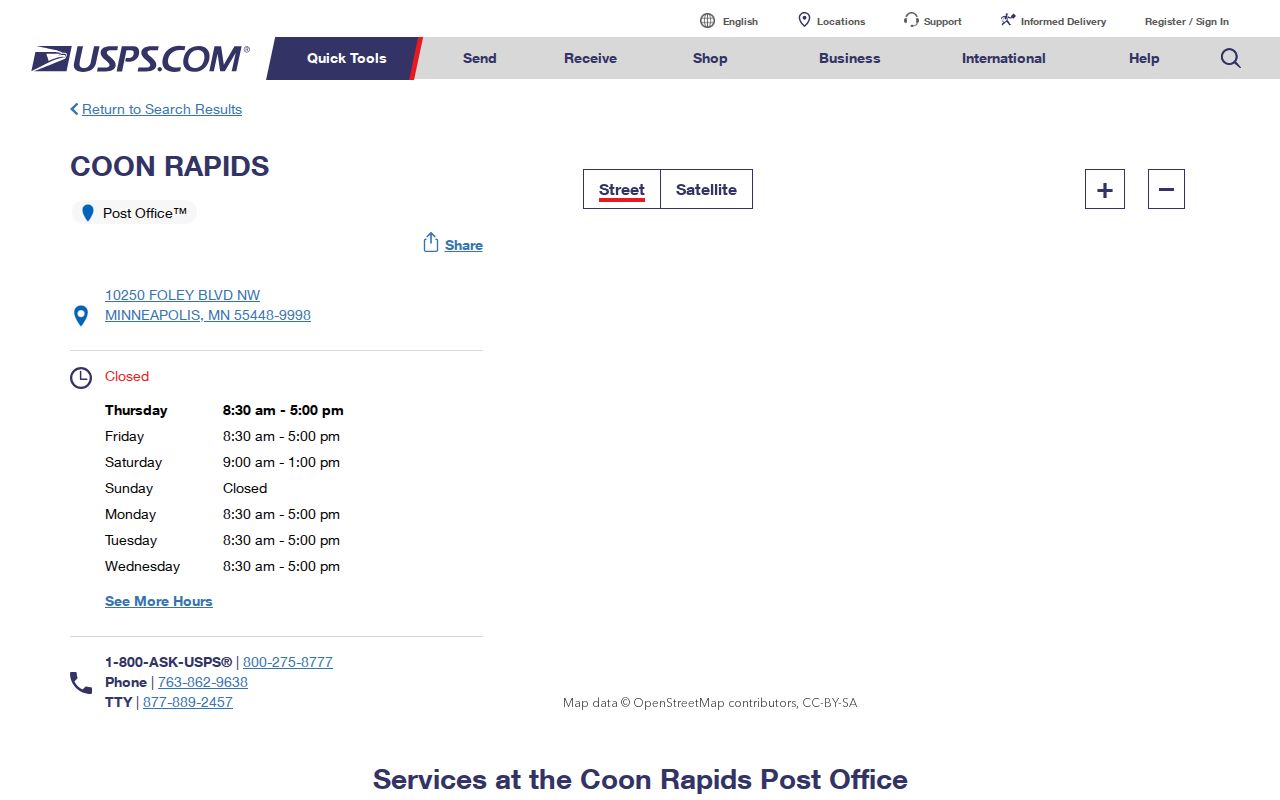
The station screen supplies the official location detail for the 55448 postal reference, but it is not a municipal boundary map.
Do not use the Minneapolis postal label to move a Coon Rapids parcel into Minneapolis, and do not use a Coon Rapids ZIP label to prove that every address with that label sits inside Coon Rapids. The parcel, its city record, and the delivery address must be checked for the question at hand.
Plan a Coon Rapids ZIP Check
Start with the complete street address rather than a name. Open Coon Rapids Planning and use the Map It address autocomplete. Select the matching address, open the parcel popup, and note the address, ZIP, and parcel ID. The popup leads toward zoning information when zoning is part of the question. This is a parcel-context method, not a resident search.
- Enter the full address in the city’s Map It autocomplete and select the matching result.
- Read the parcel popup for the address, ZIP, and parcel ID.
- Use the parcel ID or address in Anoka County GIS Property Search to view mapped parcel context, plats, historical aerials, and published map tools.
- Confirm the delivery ZIP for that address with USPS before using it in a mailing or postal search.
The official Planning link remains the source for the documented autocomplete and parcel-popup route.
Coon Rapids ZIP Code Search Modes
A ZIP can narrow a question, but the official Coon Rapids systems in the research do not provide a ZIP-wide resident roster. MNVotes has a ZIP mode for a person’s own registration check. County tax-payment search uses a PIN or part of an address. GIS searches parcels by address or PIN, and Planning Map It shows a ZIP in the parcel popup. The live assessor ZIP-filter panel was unavailable during research, so an exact ZIP-wide property filter cannot be claimed.
A careful postal workflow keeps the person, property, and delivery questions separate. Use an address to find the parcel. Use the parcel to check property administration. Use MNVotes only for the exact self-registration route. Once a ZIP narrows an address to a street, the Coon Rapids street directory explains the street-level records route.
| Official tool | ZIP or address mode | What it does not provide |
|---|---|---|
| MNVotes | ZIP mode with exact name, date of birth, house number, and selected street | A ZIP-wide browse list of voters |
| Property tax payment search | PIN or house number plus the first three street characters | A current resident search or a confirmed ZIP filter |
| Anoka GIS | Address or PIN, plus published parcel, plat, and half-section search modes | A published ZIP-wide person list |
| Planning Map It | Address autocomplete and parcel popup showing address, ZIP, and parcel ID | A delivery validation service |
Coon Rapids MNVotes ZIP Mode
MNVotes is an exact self-lookup, not a public ZIP roster. It asks for first and last name, date of birth, an address mode, house number, and a street selected from the portal. In ZIP mode, the ZIP field is required. County mode offers Anoka and then a city or township choice. The lookup returns registration confirmation or next-step guidance for the person making the check.
| MNVotes field | ZIP-mode requirement | Research note |
|---|---|---|
| First and last name | Required | Instructions allow letters, spaces, hyphens, and apostrophes, but no diacritics or non-English characters. |
| Date of birth | Required | Entered through month, day, and year controls. |
| Address mode | Required | Choose ZIP Code search or county search. |
| ZIP code | Required in ZIP mode | It works with the exact identity and address fields. |
| House number and street | Required | House number is numeric; street is selected from the portal’s options. |
Changes are updated nightly after officials process them, and the portal warns that processing can take up to 14 days. Public voter-list requests are a separate process with permitted-use limits under Minn. Stat. §201.091. A ZIP code should never be used to suggest that MNVotes exposes a public roster.
Coon Rapids Tax Search Limits
Anoka County property-tax payment search accepts a partial or full house number plus the first three characters of the street. The county advises omitting terms such as Street or Avenue, and an unassigned address may require the PIN. That is an address-or-parcel method. It is not a ZIP-wide resident search, and a taxpayer mailing address is not proof of who lives at a property.
Anoka County Property Information links tax, assessment, sales, and other property material. The live combined-search entry displayed a maintenance notice during research, so its current field order and any ZIP control remain unconfirmed. Use the official page, GIS, the property office, or the documented tax-search method rather than assuming a hidden ZIP filter exists.
The Anoka Property Access entry is the captured Coon Rapids property reference.
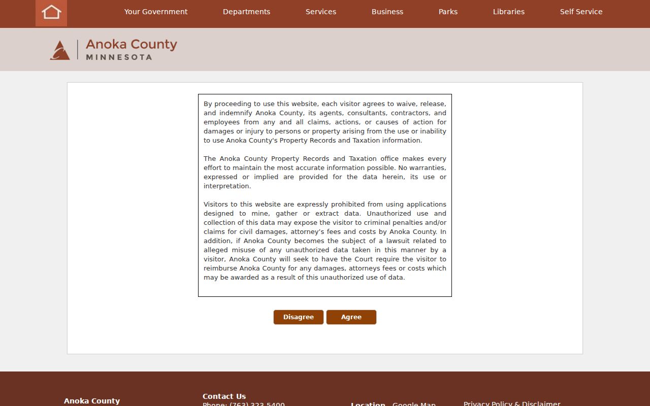
The maintenance and disclaimer screen supports a cautious handoff: use published county address and parcel routes, while treating the unexposed ZIP filter as a research gap.
Coon Rapids ZIP History
Older people and address records may not use the current Coon Rapids wording. The area’s earlier context includes Anoka Township, Anoka, and road labels such as East River Road and Coon Rapids Boulevard. Coon Rapids became a village in 1952 and a city in 1959. A historic directory, census, or deed may therefore need a place-name and parcel bridge before a modern ZIP can be useful.
Begin the historic trail with the street name as printed in the dated source, then compare it with the parcel’s legal description, plat, subdivision, or PIN. The recorder’s recorded-party trail and GIS plat context can bridge an old address to a modern parcel. The research did not locate a ZIP split or realignment year, per-ZIP population table, or registration-by-ZIP table. Those gaps should remain gaps rather than be filled with a modern map assumption.
Note: A historic mailing label is a time-specific clue, while a parcel’s legal description is often the steadier bridge between old and current addressing.
Coon Rapids ZIP Boundaries
The most important boundary rule is simple: verify delivery with USPS and jurisdiction with county or city parcel tools. The confirmed 55433 and 55448 examples establish that both serve Coon Rapids. They do not draw a complete line around each ZIP. The research did not confirm 55432 through an official USPS, city, or county source, so it remains an unconfirmed gap even where other maps may suggest an edge association.
- ZIP code
- A USPS delivery geography used to route mail, not a municipal boundary or a list of people.
- ZIP+4
- An added four-digit delivery detail used with the five-digit ZIP code for more precise mail sorting.
- PO box ZIP
- A ZIP used for post-office box delivery. The research did not identify one as Coon Rapids coverage.
- Unique ZIP
- A ZIP assigned to a single institution or organization. The research did not identify one for Coon Rapids.
- Carrier route
- A mail-delivery grouping. It is not a city boundary, neighborhood roll, or parcel line.