
Coon Rapids Previous Residents Sources
For Coon Rapids, the trail for previous residents starts with land records and then changes tools as the date moves back. Land transfers are the strongest way to establish ownership. Directories and census schedules can add a household layer, while permits, newspapers, obituaries, and maps help explain a change between formal records. The available Coon Rapids sources do not form an uninterrupted address-by-address database, so the date and the source’s limitations should travel with every conclusion.
| Source | Years It Covers | Where Held | What It Shows |
|---|---|---|---|
| Recorder and Tyler land records | Online start year not published; older county books and Room 119 access available | Anoka County Recorder / Registrar of Titles and Tyler portal | Recorded deeds, mortgages, plats, liens, and satisfactions through legal description |
| Anoka tax and property reports | Multi-year reports expressly described for 2020 to present | Anoka County Property Access | Statements, valuation notices, property cards, and proposed tax reports |
| Coon Rapids permit history | Current portal, with start year not stated | Building Inspections and BS&A | Permit number, address, and inspection-history clues |
| Minnesota state census | 1849/50/53/55/57 and 1865/75/85/95/1905 | Minnesota Historical Society | Historical household context; 1905 includes address, occupation, and residence length |
| Federal census | Minnesota schedules through 1950 under the federal release rule | NARA, FamilySearch, and library access | Household relationships, age, occupation, and address or geography |
| 1976 city directory | One exact cataloged 1976 item | FamilySearch Library catalog | Fields must be inspected in the actual image; page and publisher remain a gap |
| Telephone directories | Coon Rapids entries, exact runs not extracted | MHS Anoka County finding aid | Telephone and address leads |
| Newspapers, obituaries, and maps | Newspapers from 1863; local holdings vary by title | ACHS, Enterprise archive, and map collections | Announcements, death endpoints, road names, lots, and ownership context |
Use the most recent confirmed Coon Rapids parcel record to start a deed trail. For a date before a current address was established, maps and plats are the bridge. For a person or household, a dated directory or census record is stronger when it agrees with the land evidence for the same time.
This table also shows why a gap is not a failure. The county makes current parcel reports easier to reach than the full historic deed chain, and Coon Rapids permit history has no published online start year in the reviewed sources. For an earlier interval, move to Room 119, archival maps, a library or historical-society collection, and a precise records request when appropriate. Preserve the source and date for each finding instead of extending a modern result backward without evidence.
Coon Rapids Past Residents Begin Here
Begin with today’s parcel, not today’s name. In Anoka County property materials for Coon Rapids, note the PIN, situs address, owner or taxpayer, mailing address, and any available legal or plat context. Then open the parcel in Anoka County GIS and check the mapped shape, address, subdivision or plat layer, and adjacent land context. A mailing address can be separate from the situs, and a tax statement may still show a prior owner or taxpayer after a post-January 1 ownership change.
This first Coon Rapids step gives a stable key for the rest of the search. A current street number can be misspelled, abbreviated, or absent from older land records. The PIN, lot and block, subdivision, or other legal description provides the connection to an older recorded deed. It also helps distinguish a similarly named road or a nearby parcel from the property being researched.
Coon Rapids Past Owner Deed Chain
A Coon Rapids deed chain identifies previous owners, not automatically every past resident. Start with the current grantee’s purchase deed in the Recorder’s index. The deed identifies a grantor, usually the person or party that transferred the interest. Search that grantor as an earlier grantee to locate the transaction by which that party acquired the property. Repeat the pattern backward while comparing the legal description at every transfer.
- Collect the current PIN, owner or taxpayer, and legal description from county property records.
- Find the deed that placed the current grantee on title in the Recorder’s grantor-grantee index.
- Record the prior grantor, document type, recording date, and land description.
- Search that prior grantor as a grantee to find the earlier acquisition.
- Repeat backward, using a plat, lot and block, or Torrens or abstract reference when the street search fails.
- Use Room 119, a copy request, or older tract records when remote access stops.
- Grantor and grantee
- The grantor transfers an interest in a recorded document; the grantee receives it.
- Chain of title
- The sequence of recorded transfers used to follow ownership of one parcel through time.
- Legal description
- The lot, block, subdivision, abstract, Torrens, or other land description that identifies the property apart from a street address.
- Criss-cross directory
- A directory arranged by address to point to a possible occupant, when a verified volume includes that format.
- Enumeration district
- A census geography that helps place a household when an old address has changed or is incomplete.
At each Coon Rapids step, compare the property description before treating two same-name parties as part of the same chain. A grantor and grantee search can surface several properties or spelling variants. The county’s Tyler disclaimer compares the index to a library card catalog, which is a good reminder to try a name variant and confirm the land description. An image or certified copy can add detail, but the index alone should not be made to prove facts that were not visible in the record.
Coon Rapids Historic Address Keys
Coon Rapids legal descriptions matter most when the address trail gets old. The Recorder preserves both abstract and Torrens records, and the county describes most Anoka property as abstract. A plat or survey can show how a lot, block, subdivision, road, or tract relates to the current parcel. Anoka GIS has Plat Boundaries and Half Sections modes, while Room 119 covers real-estate and tract-record research. These are the tools to use when a street name does not match the wording in an earlier deed.
Keep recorded dates separate. The index may provide a recording date while an instrument date may appear on the document image. Record a document number, book/page, or certificate reference when it is shown, and capture the image or copy status. The research did not expose a live Coon Rapids deed image, so no fixed online field order should be assumed. The Recorder can provide records but cannot give legal advice or create an abstract of title.
Coon Rapids Past Household Pairing
Once the land chain supplies a surname and time range, shift to household evidence. The confirmed local collection path includes the 1976 Anoka-Blaine-Coon Rapids city-directory catalog item, the MHS Anoka County telephone-directory finding aid, the Coon Rapids Enterprise archive, and Anoka County Historical Society research holdings. The exact years of local telephone and reverse directories have not been extracted, and a readable 1976 directory entry was not captured. Ask to inspect the actual volume rather than filling the gap with a presumed address listing.
Pair a Coon Rapids directory year with the nearest available census year. Minnesota’s 1905 state census can provide address, occupation, and length-of-residence clues. Federal schedules can show household relationships, ages, occupations, and geography through the released 1950 census. A directory may place a name at an address, while a census can test whether the related people form the household expected at that time. Neither source should be turned into a current-resident result.
- Write down the deed date, address form, and legal description for the interval being studied.
- Locate a directory or telephone lead nearest that interval and transcribe only what the inspected page shows.
- Check the nearest state or federal census using the name, street, township, and historic labels.
- Compare household relationships and timing with the recorded transfer, then seek newspaper or obituary corroboration.
The historical collections themselves are described on the Coon Rapids city directory page. For previous residents, use them as dated checkpoints in one address’s backward trail.
The number of digitized Coon Rapids Enterprise pages makes it especially useful between directory or census dates, but it remains a newspaper search rather than a population register. Search road and township variants as well as surnames, then note whether an item is an announcement, an address reference, or a report about an event. That small distinction helps avoid attaching a person to a property merely because the two words appeared on the same page.
Coon Rapids Previous Address Map Clues
Coon Rapids records carry older place names. The area was part of Anoka Township, became a village in 1952, and became a city in 1959. The Red River Ox Cart Trail followed present East River Road and Coon Rapids Boulevard. An address or person in older material may therefore be indexed under Anoka Township, Anoka, East River Road, or Coon Rapids Boulevard instead of the current city name.
Anoka County Historical Society maps and plat books offer a concrete bridge: pre-statehood road surveys, ownership plats from 1888, 1914, and 1932, and city and county maps from the 1850s to the present. Use them with the parcel’s legal description to reconcile a road or lot name. No confirmed citywide street-renumbering year was located, so a mismatch should not be explained with an invented conversion rule.
Coon Rapids Past Address Permit Dates
Permits and newspapers can date the changes around an address. Coon Rapids says BS&A history can be searched without login by permit number or property address, offering a possible work or inspection chronology. The exact fields and the portal’s earliest online year were not captured. Treat a permit result as evidence of work at a property, then use the city’s data-request process if more public detail is needed. It is not proof of every person connected to the address.
The Coon Rapids Enterprise digital archive reports 89,119 pages from 1882 through 2023. Search a surname, street, business, marriage or death announcement, or historic road label around the deed date. The archive can close a gap between a transfer and a census, but a newspaper mention still needs to be checked against a deed, directory, census, vital record, or map.
City records are becoming more electronic, but that does not erase the older research path. The 2025/26 Coon Rapids budget material reports electronic records at 98 percent in 2024 and 2025 and plans additional historical microfilm conversion as funding allows. Future access may improve, while the present-day trail still depends on a mix of portal results, county terminals, microfilm, archives, and records requests.
Coon Rapids Recorder Trail Access
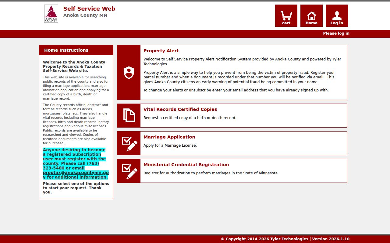
The county’s online land-record starting point is useful but incomplete. The Tyler self-service portal advertises public county record searches, including abstract and Torrens deeds, mortgages, plats, and other records. Its live panel required login when inspected, and Anoka County did not publish a verified online index cutoff year on the reviewed pages. A Coon Rapids previous residents search should state that gap plainly rather than promise a complete web chain.
The Anoka County Tyler self-service records portal is the online entry point for the Recorder’s document search.
When the remote path does not yield an image or older hit, Room 119 provides public real-estate and tract-record terminals during county office hours. The Recorder also offers copy-request routes. This office-and-portal combination is the reliable fallback, not an assumption that every deed is available from home.
Coon Rapids Past Resident Trail Ends
Obituaries, probate records, burial material, and vital indexes can explain why a name leaves the deed or directory trail. The Anoka County Historical Society holds newspapers, obituaries, cemetery and burial materials, naturalization items, maps, and research resources. The Enterprise archive can add local announcements. Probate and court records may identify heirs or an estate connection, although protected filings may not be available. Use the result as a lead, then compare it with the land description and recorded transfer.
No dedicated official Coon Rapids guide for researching a house was located. Crooked Lake Library provides reference access, and ACHS provides research support, microfilm, newspapers, maps, plat books, census, and selected civil or church resources. Sanborn map years for Coon Rapids were not confirmed in the reviewed local sources. Search the Library of Congress collection and library catalogs under Coon Rapids, Anoka, Anoka Township, and historic industrial names without assuming a local run exists.
Lawful use. Previous-resident research is appropriate for house history, family history, estate questions, and personal curiosity. Do not use records to track, harass, intimidate, or harm a living person, or to defeat an address-confidentiality program.